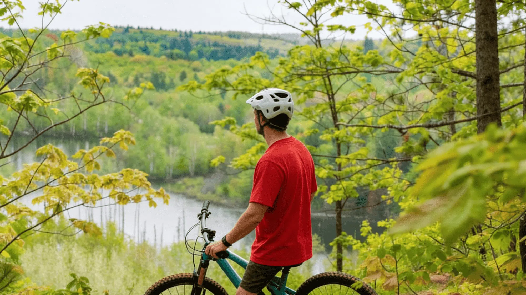


Mountain biking has grown fast across the U.S., and I’ve seen more riders hitting trails every year.
From quiet forest paths to rocky desert routes, there is something for every skill level.
Some towns have built a strong name around riding, with well-maintained trails, clear routes, and great local support for bikers.
Places like Moab, Bentonville, and Park City stand out because they offer a mix of terrain and easy trail access.
I’ve noticed that these areas make it simple to plan a ride, even if you are new to the sport.
In this guide, I’ve put together the best mountain biking trails across the country. You’ll find key details like location, difficulty, and helpful tips to make your ride smoother and safer.
How to Choose the Best Mountain Biking Trails?
Picking the right trail helps you stay safe and enjoy your ride more. It also makes sure the trail matches your skill and comfort level.
- Skill Level: Choose a trail that fits your riding ability so you stay in control and avoid risk. Start easy and move up as your balance and confidence improve.
- Trail Type: Some trails are smooth and fast, while others focus on speed or long rides. Pick based on how you like to ride and how much effort you want.
- Terrain: Trails can have dirt, rocks, roots, or steep ground that change how you ride. Check the surface before you go so you can prepare and ride safely.
One thing I always tell newer riders: difficulty ratings on trail apps don’t always match reality.
A trail rated “intermediate” in Moab’s sandstone environment is a different beast from an “intermediate” trail in Vermont’s smooth forest.
Always cross-check the trail’s surface type and elevation data against your skill set, not just the color-coded rating.
Best Mountain Biking Trails
The trails below are organized by rider reputation, geographic diversity, and trail quality. Use the stats box under each entry to compare key metrics at a glance. For current trail conditions before your ride, check Trailforks or MTB Project.
1. Whole Enchilada: Moab, Utah

This trail gives a full riding day with many types of ground. It starts in cooler areas and moves into dry land, so the view keeps changing.
The ride goes mostly downhill, which keeps the speed steady. Some parts feel rough, so riders need good control.
It suits riders who want a long ride with different sections. The mix of views and trail styles makes it one of the most talked-about rides in the country.
- 36.3 Miles | Rating: Difficult
- 85% Singletrack
- Elevation: High 11,961′ Low 7,459′
- Gain: 1,922′ Descent: 5,778′
- 4% Avg Grade (2°)
- 18% Max Grade (10°)
- Dogs: Off-leash
- E-Bikes: Allowed
- Best Season: Late April–May, September–October
- Nearest Bike Shop: Poison Spider Bicycles, Moab
2. Kingdom Trails: East Burke, Vermont

This trail system is easy to follow and works for all skill levels. Riders can choose from many paths and connect them for longer rides.
The ground feels smooth, which helps keep a steady ride. The forest keeps the area cool and quiet. It is a good place to ride without stress and still cover a good distance.
Many riders come here because it is simple to plan routes and enjoy a clean riding surface.
- 100+ Miles | Rating: Easy to Advanced
- 75% Singletrack
- Elevation: Moderate
- Gain: 1,500′ Avg
- Flow Trails Available
- Dogs: Allowed
- E-Bikes: Limited Access
- Best Season: Late May–October
- Day Pass Required: Yes (~$15–20 per adult)
- Nearest Bike Shop: East Burke Sports, East Burke
3. Downieville Downhill: California

This trail moves fast and needs strong control from start to finish. The path includes loose dirt, rocks, and sharp turns that test balance.
Riders stay focused because the trail does not slow down much. It is best for riders who like speed and can handle quick changes in direction.
The ride feels active the whole time, which makes it popular among skilled riders who want a fast and steady downhill route.
- 17 Miles | Rating: Advanced
- 80% Singletrack
- Elevation: High 7,100′ Low 2,900′
- Descent: 4,200′
- Steep Sections
- Dogs: Allowed
- E-Bikes: Not Allowed
- Best Season: June–October
- Shuttle Available: Yes (local operators in Downieville)
4. Slickrock Trail: Moab, Utah

This trail runs over hard rock instead of dirt, which makes it feel different from most rides. The surface gives good grip, so riders can stay steady while moving up and down.
The path includes short climbs and dips that repeat.
The open area gives clear views all around. Slickrock is one of the most photographed trails in the world for good reason, but first-timers often underestimate it.
It suits riders who want a steady ride on firm ground without loose soil or thick trees blocking the path.
- 10.5 Miles | Rating: Intermediate
- 100% Rock Surface
- Elevation: Moderate
- Gain: 1,400′
- Loop Trail
- Dogs: Allowed
- E-Bikes: Allowed
5. Bentonville Trail System: Arkansas

This trail system is built for easy riding and quick access. Riders can start from many spots, which makes planning simple.
The paths feel smooth and safe, which helps new riders gain confidence. At the same time, some sections add more challenge.
The town supports biking well, so everything feels close and easy to use. It is a good place for both learning and regular riding without stress.
- 70+ Miles | Rating: All Levels
- 60% Singletrack
- Elevation: Low
- Flow Trails
- Bike-Friendly Town
- Dogs: Allowed
- E-Bikes: Allowed
- Best Season: Year-round (mild winters)
- Nearest Bike Shop: Phat Tire Bike Shop, Bentonville
6. Tsali Trails: North Carolina

These trails offer a calm and steady ride with wide paths and soft turns. The layout is simple, so riders do not get lost easily.
The ride moves near water in some parts, adding nice views. The ground stays even, which helps keep control without much effort.
It is a good choice for riders who want a smooth ride that still covers distance without hard or tricky sections.
- 40 Miles | Rating: Intermediate
- 65% Singletrack
- Elevation: Moderate
- Loop Trails
- Scenic Lake Views
- Dogs: Allowed
- E-Bikes: Not Allowed
- Best Season: Spring and Fall
7. Buffalo Creek Trails: Colorado

This area gives a mix of smooth dirt and small rocks, which keeps the ride balanced. The space feels open, so riders do not feel crowded.
The paths allow long rides without many stops. Trees give shade and keep the ride cool.
It suits riders who want a steady path with some small changes but not too much difficulty or sharp turns along the way.
- 50+ Miles | Rating: Intermediate
- 70% Singletrack
- Elevation: Moderate
- Rolling Terrain
- Forest Trails
- Dogs: Allowed
- E-Bikes: Allowed
- Best Season: May–October
8. Pisgah National Forest: North Carolina

These trails feel more natural and less shaped, which adds more challenge. The path includes roots, rocks, and uneven ground that need attention.
Riders go through climbs and drops that keep the ride active. Trees cover most of the area, giving shade.
It suits riders who want a raw trail feel and do not mind rough ground or more effort during the ride.
- 100+ Miles | Rating: Advanced
- 80% Singletrack
- Elevation: High
- Steep Climbs
- Technical Terrain
- Dogs: Allowed
- E-Bikes: Limited
- Best Season: Late Spring–Fall (avoid after heavy rain)
- Standout Routes: Black Mountain Trail, Daniel Ridge Loop
9. Park City Trail System: Utah

This system has many connected trails that make long rides easy to plan. Riders can move from one path to another without stopping.
The ground stays mostly smooth with some rough parts. Many entry points help riders start from different areas.
It suits riders who want choice and long rides without repeating the same route again and again. Park City’s trail system is unique because it operates year-round in both summer and winter (ski season).
In summer, the Park City Mountain Resort opens its lift for bike access, which gives riders descent-only options from higher elevations without the climbing.
- 400+ Miles | Rating: All Levels
- 75% Singletrack
- Elevation: High
- Long Routes
- Lift Access Available
- Dogs: Allowed
- E-Bikes: Allowed
- Best Season: June–October
- Standout Route: Wasatch Crest Trail
10. Crested Butte Trails: Colorado

These trails run through open mountain areas with wide views. The ride includes steady climbs and smooth drops that keep the movement going.
The ground changes in parts, which adds some variety. The area feels open and fresh, which makes long rides more enjoyable.
It suits riders who like long paths with space and a mix of effort and easy movement.
- 100+ Miles | Rating: Intermediate
- 70% Singletrack
- Elevation: High
- Alpine Terrain
- Seasonal Access
- Dogs: Allowed
- E-Bikes: Limited
- Best Season: Late June–September (trails often snow-covered until mid-June)
11. Sedona Trails: Arizona

These trails run through red rock areas with narrow paths and quick turns. The ground feels firm but uneven, so riders need steady balance.
Many sections change direction often, which keeps the ride active. The open space gives clear views, and there are not many trees blocking sight.
It suits riders who enjoy short climbs and drops while staying alert. The ride feels busy but not too long, making it a good choice for steady and focused riding.
- 200+ Miles | Rating: Intermediate
- 80% Singletrack
- Elevation: Moderate
- Rocky Terrain
- Technical Sections
- Dogs: Allowed
- E-Bikes: Allowed
12. Tahoe Rim Trail: California/Nevada

This trail runs along mountain edges and passes through forest and open land. The ride feels long and steady, with views of water and hills along the way.
Some parts are smooth, while others feel rough, which adds small changes during the ride. The path stays clear and easy to follow.
It suits riders who enjoy long rides with fresh air and wide views, without too many tight turns or crowded sections slowing them down.
- 165 Miles | Rating: Intermediate
- 70% Singletrack
- Elevation: High
- Mixed Terrain
- Scenic Views
- Dogs: Allowed
- E-Bikes: Limited
13. Galbraith Mountain: Washington

This trail area has many short paths that connect well, making it easy to change routes. The ground feels soft in some places, which helps with grip.
Trees cover most of the area, keeping it cool and shaded. Riders go through turns and small rises that keep the ride moving.
It suits riders who want quick loops and variety without long travel between sections. The layout helps riders adjust rides based on time and skill.
- 65+ Miles | Rating: Intermediate
- 75% Singletrack
- Elevation: Moderate
- Forest Terrain
- Flow Sections
- Dogs: Allowed
- E-Bikes: Allowed
14. Oakridge Trails: Oregon

These trails are known for long downhill rides through forest areas. The path stays mostly smooth but includes roots and rough spots that need care.
The ride often begins higher and moves down, which keeps the speed steady. Trees provide shade across most of the route.
It suits riders who want long rides with less climbing and more flow. The path feels natural and keeps the ride simple but still active.
- 300+ Miles | Rating: Intermediate
- 80% Singletrack
- Elevation: High
- Long Descents
- Forest Trails
- Dogs: Allowed
- E-Bikes: Limited
15. Sun Valley Trails: Idaho

This trail system gives wide open space and clear paths for easy riding. The ground feels smooth and steady, which helps keep a constant pace.
Riders can link many routes without much effort. The open setting allows good visibility ahead, making it easier to stay on track.
It suits riders who want long rides without tight turns or heavy traffic. The area feels calm and allows riders to ride without pressure.
- 400+ Miles | Rating: All Levels
- 70% Singletrack
- Elevation: Moderate
- Open Terrain
- Long Routes
- Dogs: Allowed
- E-Bikes: Allowed
16. Brevard Trails: North Carolina

These trails mix smooth dirt paths with rough ground like roots and small rocks. Riders move through forest areas where paths feel natural and are not shaped too much.
The ride includes both climbs and drops, which keeps it active. The ground changes often, so riders stay alert.
It suits riders who want a mix of easy and harder sections without extreme effort. The forest setting keeps the ride quiet and steady.
- 100+ Miles | Rating: Intermediate
- 75% Singletrack
- Elevation: Moderate
- Mixed Terrain
- Forest Trails
- Dogs: Allowed
- E-Bikes: Limited
17. Fruita Trails: Colorado

This trail area runs through dry land with open space and clear paths. The ground feels firm, with some small rocks adding a light challenge.
The layout allows smooth riding without many stops. Riders can see far ahead, which helps with control and planning.
It suits riders who want steady movement in a dry setting without heavy tree cover. The path stays simple and easy to follow for most of the ride.
Fruita is often overshadowed by Moab, but it’s a genuinely excellent destination for intermediate riders who want technical desert riding without Moab’s crowds or difficulty level.
The 18 Road trail system is the main draw, and the small town of Fruita has a tight-knit bike community with a few good local shops.
- 100+ Miles | Rating: Intermediate
- 70% Singletrack
- Elevation: Moderate
- Desert Terrain
- Flow Trails
- Dogs: Allowed
- E-Bikes: Allowed
18. Grand Targhee Trails: Wyoming

These trails run through mountain areas with wide open views and fresh air. The paths feel quiet and less crowded, which helps riders focus.
The ground includes smooth parts and some uneven spots. Riders move through gentle rises and drops that keep the ride steady.
It suits riders who want space and a calm ride without busy trails. The area allows riders to enjoy long rides without much noise or crowds.
- 70+ Miles | Rating: Intermediate
- 75% Singletrack
- Elevation: High
- Alpine Terrain
- Scenic Routes
- Dogs: Allowed
- E-Bikes: Limited
19. Stowe Trails: Vermont

This trail network runs through forest areas with many connected paths. The ground feels smooth in most parts, with some light rough sections.
The layout helps riders move from one trail to another with ease. Trees provide shade, making the ride comfortable.
It suits riders who want a steady ride with simple paths and light changes. The area allows riders to ride longer without dealing with hard or sharp sections.
- 100+ Miles | Rating: Intermediate
- 70% Singletrack
- Elevation: Moderate
- Forest Terrain
- Flow Sections
- Dogs: Allowed
- E-Bikes: Limited
20. Hurricane Ridge: Washington

This trail runs along open ridges with wide views of mountains and sky. The path feels simple and clear, with gentle changes in height.
There are fewer trees, so the area feels open and bright. The ride stays steady without sharp turns or tight paths. It suits riders who enjoy open space and calm riding.
The trail gives a different feel compared to forest paths and keeps the ride relaxed.
- 20+ Miles | Rating: Intermediate
- 65% Singletrack
- Elevation: High
- Ridge Terrain
- Scenic Views
- Dogs: Allowed
- E-Bikes: Not Allowed
21. Santa Cruz Trails: California

These trails run through forest areas near the coast, giving a mix of cool air and steady ground. The paths include tight turns and small rises that keep the ride active.
Some sections feel smooth, while others need more control. The trees provide shade, and the layout keeps riders engaged.
It suits riders who want a mix of calm riding and light challenge without long or tiring climbs throughout the route.
- 50+ Miles | Rating: Intermediate
- 75% Singletrack
- Elevation: Moderate
- Coastal Forest Terrain
- Flow Sections
- Dogs: Allowed
- E-Bikes: Limited
22. Marquette Trails: Michigan

This trail system offers well-kept paths with clear signs and smooth riding lines. The ground feels firm, making it easy to keep a steady pace.
Riders move through forest areas with small changes in height. The layout helps riders choose shorter or longer routes easily.
It suits riders who want a clean and simple ride without rough sections. The area is known for being easy to use and good for regular riding.
- 60+ Miles | Rating: Intermediate
- 70% Singletrack
- Elevation: Moderate
- Forest Terrain
- Smooth Trails
- Dogs: Allowed
- E-Bikes: Allowed
23. Duluth Traverse: Minnesota

This trail runs across the city and connects many riding areas into one long route. The path moves through forest sections and open spaces, giving variety without being hard to follow.
The ride stays steady with small ups and downs. It suits riders who want a long route without sharp turns or rough ground.
The layout makes it easy to ride different parts without getting lost or repeating the same section.
- 100+ Miles | Rating: Intermediate
- 70% Singletrack
- Elevation: Moderate
- Mixed Terrain
- Long Route
- Dogs: Allowed
- E-Bikes: Allowed
24. Anchorage Trails: Alaska

These trails run through wide open areas and forest paths, giving a mix of space and cover. The ground feels firm in most parts, which helps keep balance.
Riders can enjoy long rides without heavy traffic. The setting feels quiet and calm, adding to the ride. It suits riders who want simple paths and open surroundings.
The layout allows riders to move freely without dealing with tight or crowded sections.
- 120+ Miles | Rating: Intermediate
- 65% Singletrack
- Elevation: Low to Moderate
- Mixed Terrain
- Open Space
- Dogs: Allowed
- E-Bikes: Allowed
25. Brown County State Park: Indiana

This trail system offers well-marked paths that are easy to follow. The ground feels smooth in many sections, with some small rough spots adding light change.
Riders move through wooded areas with steady turns and gentle rises. The layout helps riders pick routes based on time and skill.
It suits riders who want a simple ride with clear paths and steady movement without hard or sharp sections.
- 30+ Miles | Rating: Beginner to Intermediate
- 70% Singletrack
- Elevation: Moderate
- Forest Terrain
- Loop Trails
- Dogs: Allowed
- E-Bikes: Allowed
26. Bootleg Canyon: Nevada

This trail area offers dry ground with open views and strong sunlight. The paths include loose dirt and rocks that need steady control.
The ride feels fast in some parts, with quick changes in direction. The open space allows clear sight ahead, helping riders stay aware. It suits riders who want a mix of speed and control in a dry setting.
The trail keeps riders active without long flat sections.
Bootleg Canyon sits just outside Boulder City, Nevada, which makes it an accessible day trip from Las Vegas.
The trail is built on Bureau of Land Management land and is free to ride year-round, with the exception of summer midday heat.
- 30+ Miles | Rating: Advanced
- 80% Singletrack
- Elevation: Moderate
- Desert Terrain
- Technical Sections
- Dogs: Allowed
- E-Bikes: Limited
27. Whitefish Trail: Montana

This trail runs through forest areas with clean paths and steady ground. The layout allows riders to move between sections without confusion.
The ride includes gentle climbs and smooth turns that keep movement easy. The trees provide shade and make the ride comfortable.
It suits riders who want a calm and steady ride without rough terrain. The trail system works well for both short and longer rides.
- 45+ Miles | Rating: Intermediate
- 70% Singletrack
- Elevation: Moderate
- Forest Terrain
- Scenic Routes
- Dogs: Allowed
- E-Bikes: Allowed
Best Mountain Biking Towns in the USA
Some places have many trails, a strong bike culture, and easy access to rides. These towns make it simple to plan and enjoy mountain biking.
| Town | State | Skill Level | Why It’s Popular |
|---|---|---|---|
| Moab | Utah | Advanced | Dry trails, long rides, famous routes |
| Bentonville | Arkansas | Beginner–Intermediate | Easy trails, bike-friendly town |
| Park City | Utah | All levels | Many connected trails, easy access |
| Sedona | Arizona | Intermediate | Red rock paths, open views |
| Crested Butte | Colorado | Intermediate–Advanced | Mountain trails, long scenic rides |
Best Time to Ride in Each Region
Weather plays a big role in trail conditions across the U.S. Choosing the right season helps you ride safely and enjoy better ground.
1. West Coast
The West Coast has a long riding season, but timing still matters. Spring and fall are the best because the weather stays cool and the trails are dry.
Summer can get very hot, especially in dry areas, which makes riding harder. Winter works well in lower places where snow is rare.
In many areas, riding is good from late spring to early fall, but rain can make trails soft and unsafe for riding.
2. Mountain Regions
Mountain areas have a shorter riding season due to snow and cold weather. The best time is from late spring to early fall when trails are clear and dry.
Summer gives the best riding days with stable ground and open paths. Early spring may still have snow, and winter often blocks access.
In high areas, the weather can change fast, so riders should plan ahead before going for long rides.
3. East Coast
The East Coast offers good riding for most of the year, but rain affects trails often. Spring and fall are the best times because the weather is cooler and the ground is firm.
Summer can feel humid, which makes riding tiring. Winter may bring mud or frozen ground, which can make trails unsafe.
Riding on wet trails should be avoided, as soft ground can get damaged and become harder to use later.
4. Southern States
Southern states allow riding almost all year due to warm weather. Fall and winter are often the best because the temperature is lower and trails stay dry.
Summer can get very hot, which makes long rides harder and less safe. Some areas even have good winter riding conditions when other regions have snow.
Riders should plan rides early in the day and carry enough water in warm months.
5. Southwest (Desert Regions)
Moab, Sedona, Fruita, and Bootleg Canyon all share the same seasonal logic: the riding window is spring (March–May) and fall (September–November).
Summer temperatures in the desert regularly reach 95–110°F, which makes afternoon rides unsafe and drains performance significantly.
Winter riding is often possible in lower-elevation desert areas, making the Southwest one of the few regions where January and February can deliver excellent trail conditions.
What You Need Before Riding?
The right gear makes your ride safer and more comfortable. It also helps you stay prepared for any small issues on the trail.
- Helmet: A helmet protects your head and reduces the risk of injury during falls. Always wear one that fits well and feels secure while riding.
- Hydration Pack: A hydration pack helps you carry water and stay hydrated during rides. It is useful for longer trails where water stops are not available.
- Trail Map or GPS: A map or GPS helps you stay on the right path and avoid getting lost. It also makes route planning easier before you start your ride.
- Repair Kit: A repair kit helps fix small issues like flat tires during your ride. Carry basic tools so you can continue without long delays.
On desert trails, especially, I carry a minimum of 3 liters of water for any ride over 10 miles.
Dehydration creeps up faster than riders expect in low-humidity environments where sweat evaporates before you notice it.
A small electrolyte packet or tab (not just plain water) makes a meaningful difference on rides over 2 hours.
Gear Notes by Terrain Type
Different terrains need different gear setups to stay safe and ride better. Tire choice and timing matter a lot, so use this quick guide to match your gear with the trail conditions.
| Terrain | Tire Recommendation | Key Safety Note |
|---|---|---|
| Desert (Moab, Sedona, Fruita) | Semi-slick center, aggressive side knobs | Start early — surface temps peak by 11 AM |
| Forest/East Coast (Pisgah, Brevard) | Aggressive all-around mud tire | Assume the trail is damp — lower tire pressure for grip |
| Alpine (Park City, Crested Butte) | 2.4–2.6″ volume for cushioning | Weather changes fast above 9,000′ — carry a shell layer |
| Flow/Bike Park (Bentonville, Galbraith) | Light tread, moderate volume | Wear knee and elbow pads even on “easy” jump lines |
Trail Maps and Resources
Use these tools to find and plan your rides. They help you stay on track and choose the right trail. Trail maps and simple tools make planning your ride much easier and safer.
Apps like Trailforks and MTB Project show clear routes, trail details, and user updates, which help you pick the right path before you start.
These tools also help you track your ride and avoid getting lost. Local bike shops are useful because they share real advice about nearby trails and current conditions.
Park websites also provide basic details like trail rules, closures, and maps.
Using a mix of these options helps you plan better, ride with confidence, and avoid common problems on new trails.
Trail Tips for First-Time Riders
Simple tips can help you avoid common mistakes on the trail. They also make your ride safer and easier to manage.
| Tip | What It Means |
|---|---|
| Start with easy trails | Begin with simple paths to build confidence |
| Check weather | Look at the weather before riding to stay safe |
| Ride with a friend | Go with someone for safety and support |
| Respect trail rules | Follow rules to protect yourself and others |
Conclusion
The U.S. offers many great riding spots, from desert paths to forest trails and mountain routes. Each place gives a different riding feel, so choosing based on your skill and location helps you enjoy the ride more.
The best mountain biking trails are not just about difficulty, but also how well they match your comfort and riding style.
One thing I keep coming back to is this: the best ride isn’t always the most famous one.
Some of the most satisfying days I’ve had on a bike were on lesser-known trails in places like Duluth and Oakridge, uncrowded, well-maintained, and genuinely fun.
A 10-minute conversation with someone at a local bike shop will tell you more than any trail app about what’s actually worth riding on any given day.
Pick a trail near you, check the route, and plan your next ride today to enjoy a better mountain biking trip.


